
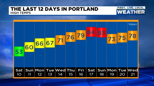
Interesting month so far. We started the month off with some very chilly – even record cold low temperatures, but wow how it has switched and turned around! We just had an incredible stretch of warm April weather with a new record high occurring this past Saturday with a high of 85° – a whopping 24 degrees above normal!!! This graphic from Mark Nelson with Fox 12 Oregon shows high temps in Portland and gives a good visual of our accent from very chilly weather earlier in the month to the record warmth we recently experienced.
The other record we are currently working on is a record dry April. Do you realize we have only picked up 5% of our typical rainfall for this point in the month? We are running way behind average! I have some good news though as rain looks to arrive this weekend. Okay, so rain on the weekend is not necessarily the best timing lol, but we need the rain; otherwise it’s going to be one heck of a summer.
The next 7 days and forecast highlights
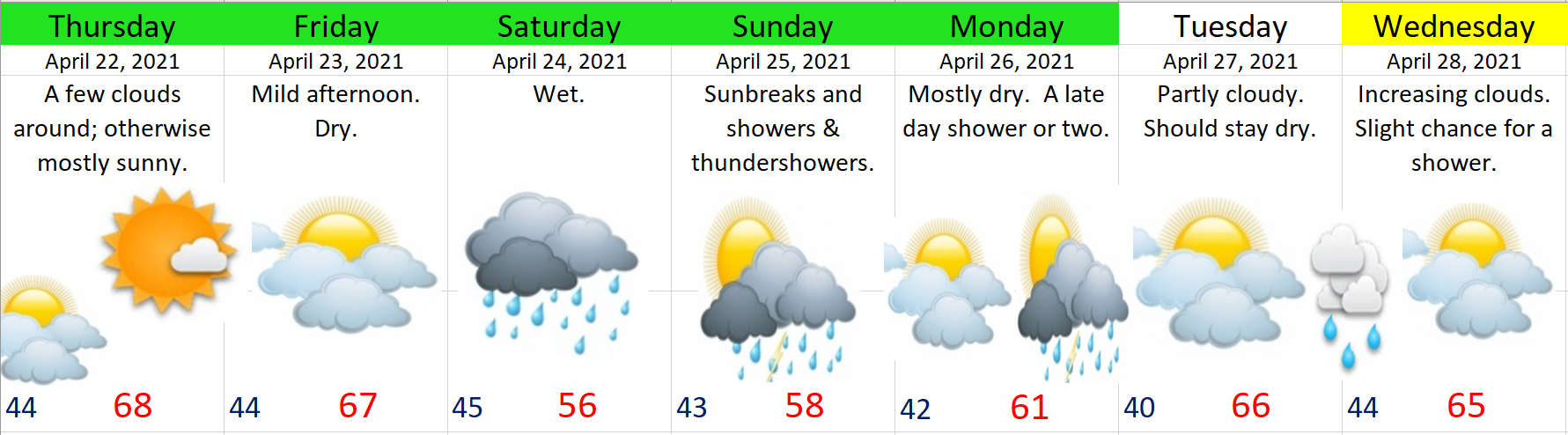
Basically rain continues on and off through much of next week, so hopefully we make up some of that deficit.
The wettest days will be Saturday and Sunday. We do have a shot at seeing a few thundershowers on Sunday. Monday should be mostly dry with showers late in the day, and as it stands now, Tuesday looks to be a fairly dry.
There you have it. Have a great rest of your work week and stay safe!
