
The sunshine outside is making it feel like a distant memory, but it doesn’t change the fact that we have seen some really chilly nighttime lows (for April) lately. Sunday morning Salem tied its record low of 29°! This nice graphic from The National Weather Service in Portland shows how record lows were widespread this morning across western Oregon.

Despite having a few mild afternoons (our average high this time of year is 60°), Salem is actually running1.8 degrees below normal for the month thanks to these very cold morning lows. Change is coming this week as much warmer weather moves in.
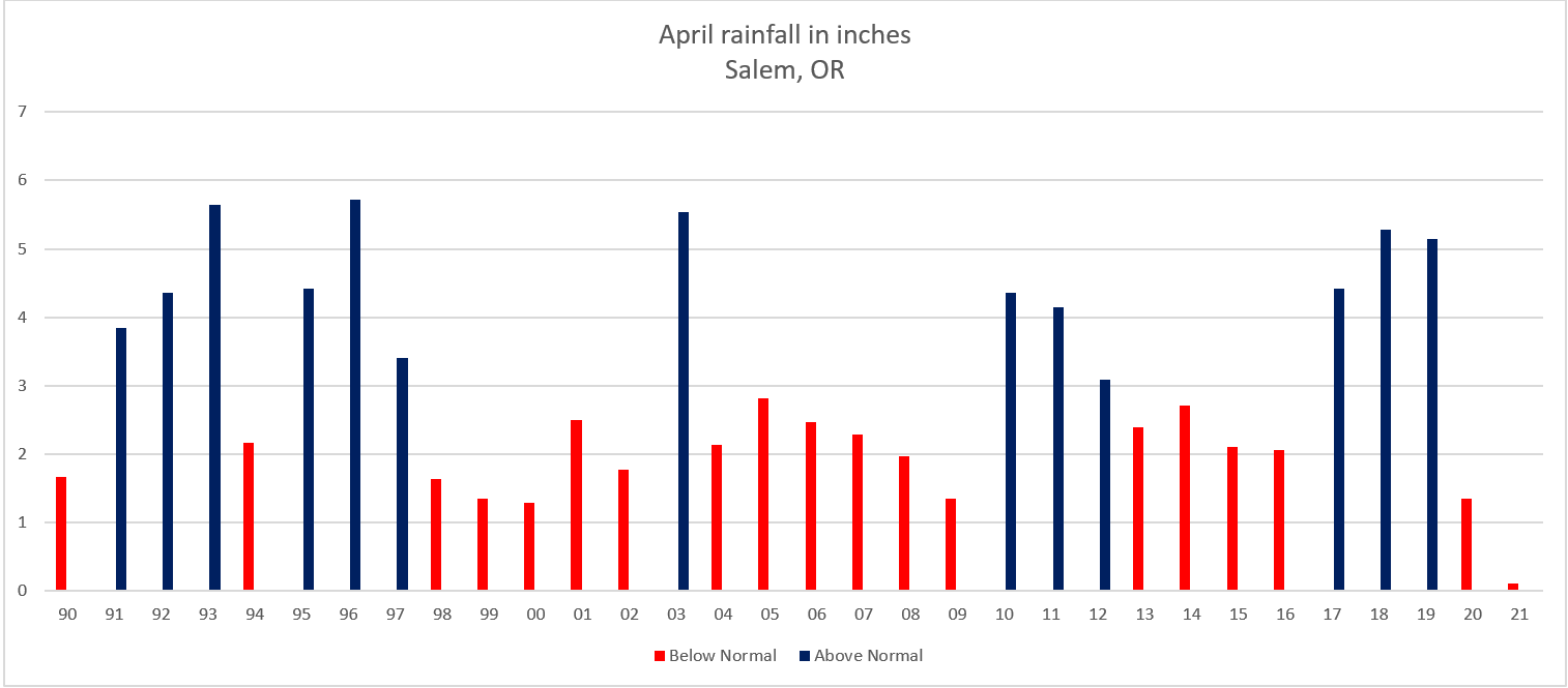
The other interesting thing this month has been the unusually dry weather. Very odd for April to be this dry. Do you realize that we’ve seen a mere 9% of our typical rainfall for this point in the month?!? It’s going to be a long summer if we don’t get a few good soakings later this spring. This graph shows the total rainfall for each April since 1990. Red years were below average while blue ended up with wetter than normal rain totals.
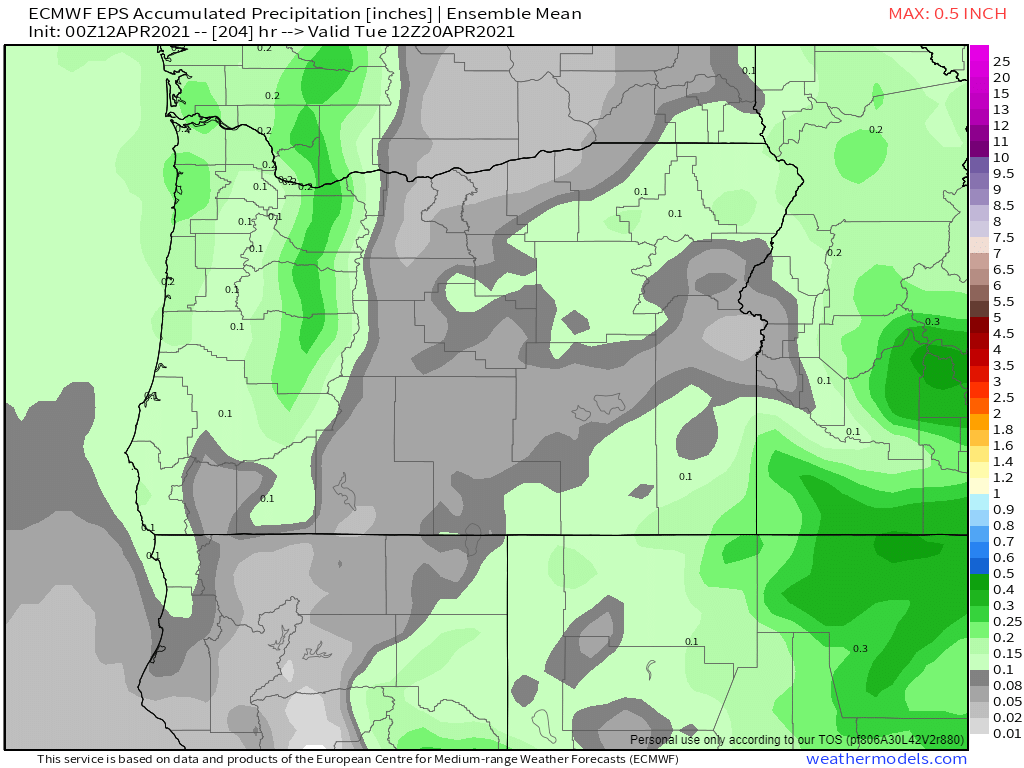
This next map shows estimated total rainfall in inches through next Monday. Basically nothing more than maybe a tenth of an inch falling on next Monday which means our extremely dry April is going to continue.
Might as well make the most of the dry weather though. For all we know May could be gloomy and wet. This whole week and coming weekend will be dry – no question about it with the next chance of rain being (as stated above) next Monday at the soonest. The warmest days will be Thursday – Sunday with highs in the 70s and maybe even low 80s Saturday and Sunday!!
There you have it. Enjoy the sunny and warm weather!

Interesting graphics and facts! 🙂 I have been enjoying the dry weather, but I’m all for us getting some rain soon!
LikeLike