This week has gone pretty much as planned with showers today and continuing through tomorrow. Here’s a quick look at what you can expect now through Sunday.
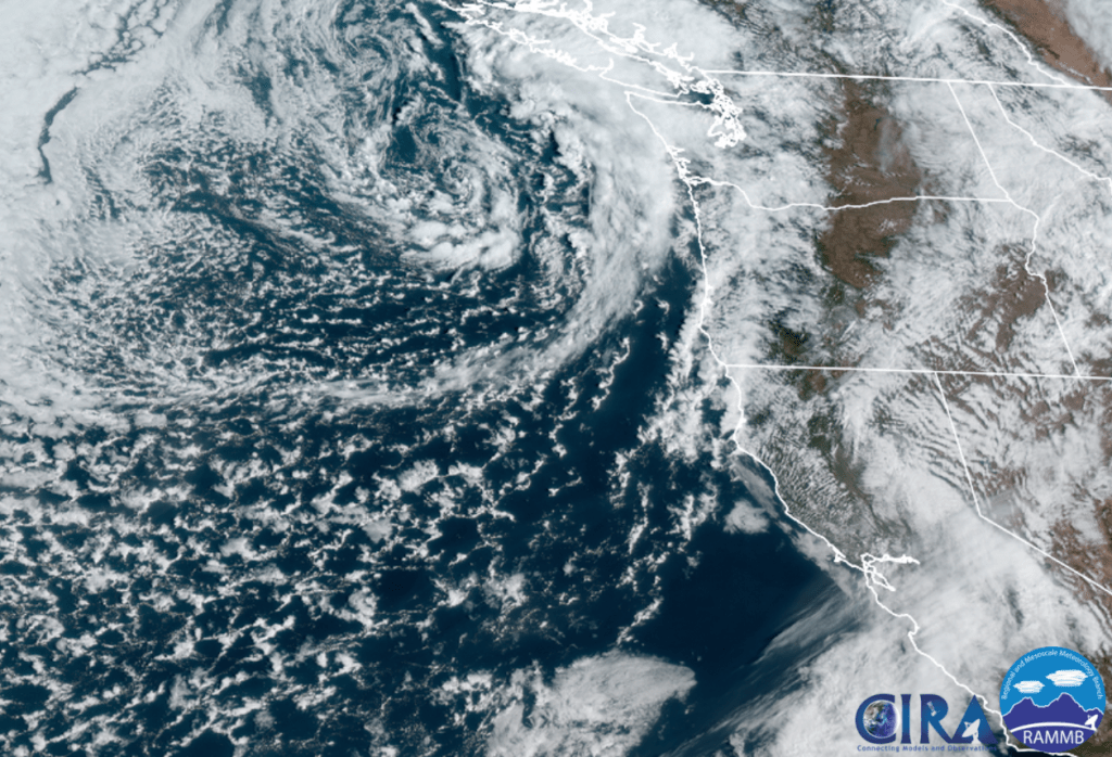
- Today & Saturday will both be active days around here. Sunbreaks, lot of available moisture, and very cold air aloft (up in the atmosphere) will combine to give us a threat of a few thundershowers, downpours, and hail. Some of the showers could contain a lot of hail, so be careful if you are caught out on the road when one of these showers hits. This satellite pic from around 10:45AM shows a nice swirl of clouds and bands of heavy showers rotating towards Oregon. This will be our weather pattern through Saturday evening.
- Snow levels are around 2000 – 2500′ with 5 to 10 inches of new snow falling in the Cascades through Saturday night. Expect snowy passes Monday, Wednesday and Thursday of Spring break.
- Sunday will be the driest day this weekend with rain moving in sometime after roughly 3PM.
Spring Break
What everyone wants to know is which days are going to be nice and dry for outdoor activities, and which days are going to be wet. Fortunately, this guy right here has you covered! 😉
1.) Our mostly wet days will be Monday, Wednesday, and Thursday. These days will all have dry times mixed in between the showers, but overall expect these days to be wet.
2.) Now for the dry days! Tuesday, Friday, and next Saturday, & Sunday all look nice and dry!!! 🙂 🙂 So we should finally see a completely dry weekend around here!
There you have it. Stay safe, try to stay dry, and have fun out there!

