
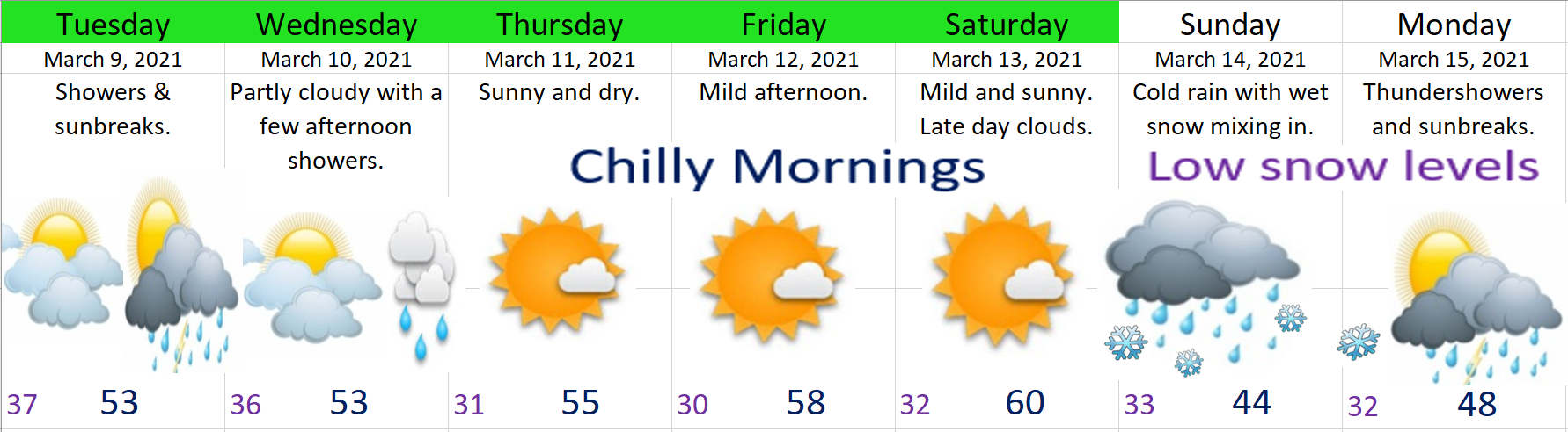
Checking out the radar this afternoon you can see a few scattered showers around with lots of dry breaks in between. Showers here and there, but the majority of the day has been dry. Expect basically the same exact thing both Tuesday and Wednesday.

Extended Forecast
Highlights
Thursday – Saturday: Totally Dry. Cool nights and mornings with lows dipping to freezing each night, but mild and sunny afternoons.
Sunday: A powerful and dynamic cold front moves in lowering snow levels close to the valley floor. I’ll keep an eye on this storm, but for now plan on valley rain with snow in the mountains above 1000′. This system will leave behind some very chilly showers on Monday with highs struggling to reach 50°.
The Cascades
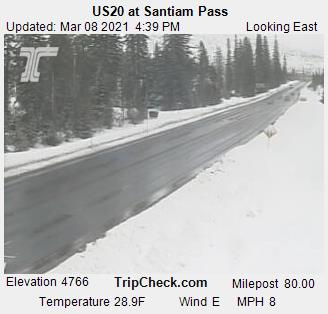
This time of year the roads generally stay clear of snow and ice during the daylight hours and this week is no exception. The road cam at the top of Santiam Pass shows this well. Temps below freezing with occasional snow falling; however, the road surfaces themselves are above freezing thanks to the increased energy output of the March sun.
I expect several more inches of new snow now through Wednesday night keeping a fresh layer of snow up there.
Sunny and mild Thursday – Saturday, but big time snowfall coming for Sunday and Monday with the cold storm system posed to move in.
There you have it! Take care and stay safe.
