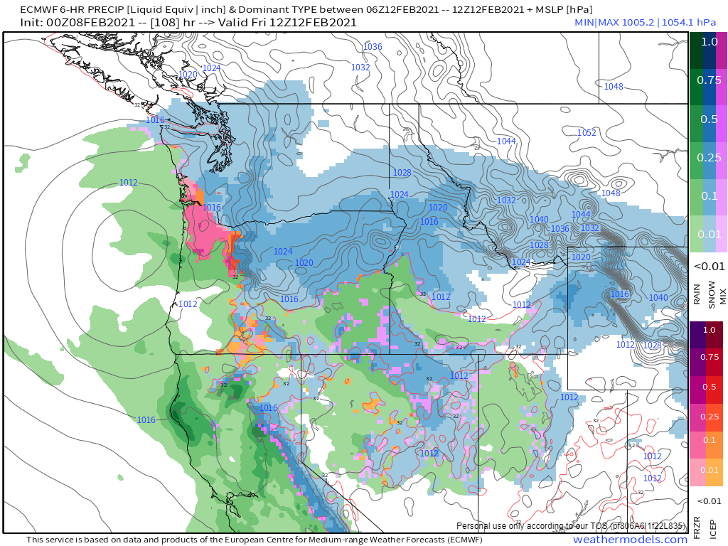
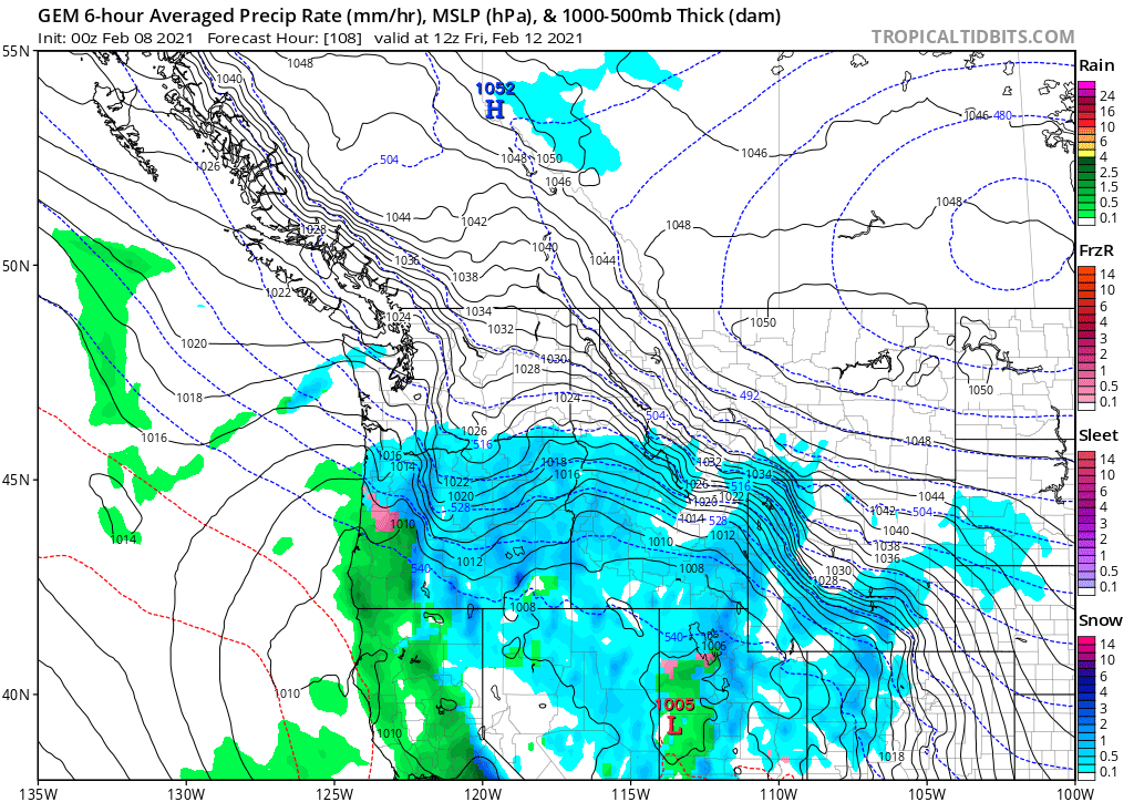
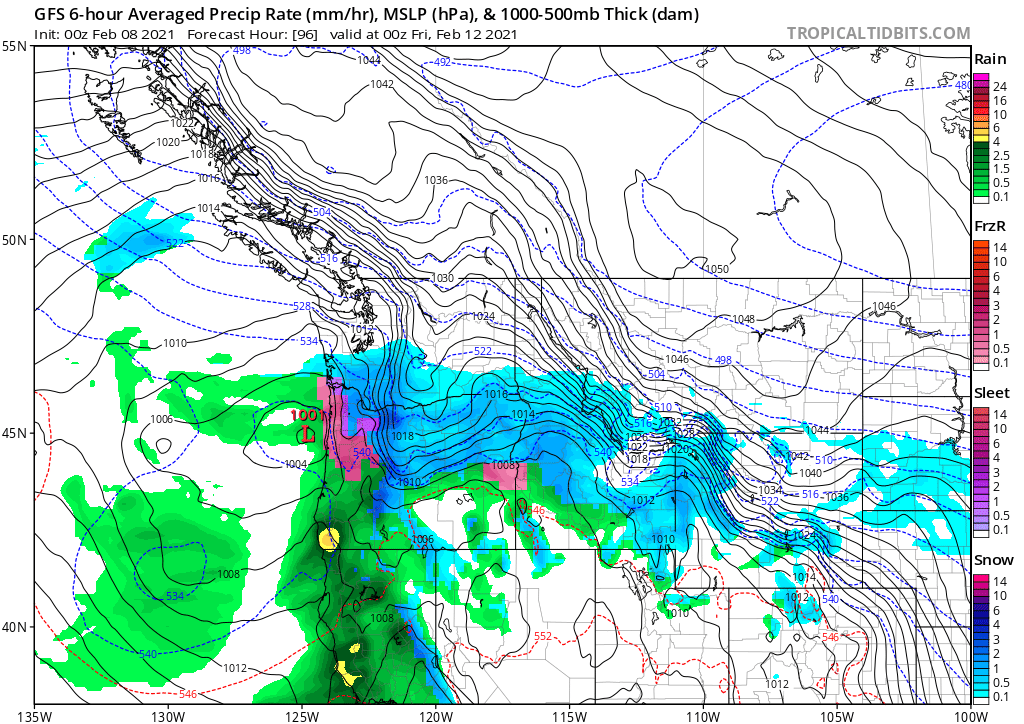
Our chances for snow have definitely increased since the last time I posted, but we still have a ways to go before I get too excited about us seeing a lot of snow. In my mind, these maps do a great job of illustrating why it’s so difficult to predict snow around here, specifically when it’s still several days out. Below is a slideshow of the 3 major weather models and their latest predictions for Thursday and Friday.
The first model shows Salem getting what would likely be mostly rain with a little bit of freezing rain possible, and maybe some snow mixed in if we are lucky. Overall though, this outcome would bring mainly rain to our area. Yeah, I know that’s what was said a few weeks ago when we saw that surprise snowstorm, and I imagine if this scenario played out there would still be a very slim chance of it being mostly snow, but I wouldn’t bet on it. The second model shows Salem receiving a good ol’ fashioned snowstorm with possibly several inches! The third and final model shows rain to freezing rain to eventually all snow. It also showed Salem getting snow next Saturday, Sunday, and the following week! A very snowy run indeed!
Like humans, none of these models are perfect and they each have their strong suits and their uh well not so strong suits. Knowing those and factoring those in is tough in a situation like this.
I know what you’re thinking, “make a dang forecast already! Haha. Here’s what I’m willing to say:
1.) This week will be the coldest week we have seen in at least 2 years. Lots of 20s and 30s at night and even some daytime highs not making it out of the 30s – maybe even colder if things work out just right, or wrong depending on your point of view. 😉
2.) Snow in Salem is fairly likely. Too much still up in the air to know if this will be a once in a decade type series of snowstorms (notice the plural there as some of the possible outcomes being predicted are showing several storms), will it be a run of the mill snowstorm, or will it be a quick hitter like what we saw a few weeks ago where it basically started melting as soon as the snow stopped falling. Or, there’s still a slim, and getting slimmer chance that we just see rain, but I’m hoping we can remove that possibility altogether real soon depending on what the new forecasts that come out later today look like. Bottom line is odds are high we see at least one more snow event of some sort whether it’s big or small and whether we see one or several is still unknown.
3.) Timing for this snow would be Thursday at the soonest, but more likely Friday or even Saturday. Many of the outcomes I’ve looked at have snow Friday, and again Saturday night or Sunday, and a surprising amount have even shown additional snow in the week to follow. I’m really hoping to have better idea tomorrow at least with the Thursday/Friday storm system.
4.) Monday through Wednesday will be fairly chilly, but no threat of snow on these days.
Look for updates all week long as there will be lots of twists and turns as we navigate what could shape up to be a very interesting week.
Take care!


