A real quick update tonight.
As mentioned in my previous forecast, temps really need to drop around 30° or colder tonight if we want it to snow tomorrow and that’s probably not going to happen. In this particular setup the west side of the Willamette Valley does better than the east side. There are a few reasons for that, but basically cool air blowing out of the gorge sorta pools up against the Coast Range allowing those communities to be colder than the rest of the valley. Yes, that is a real thing 🙂 😉
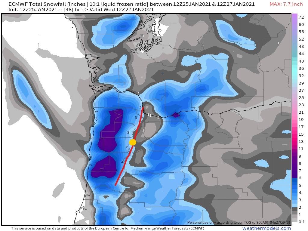
Take a look at this snow map showing snow in the Coast Range and for the locations and cities on the western edge of the valley. Salem is the big gold colored dot. It shows us getting some snow, but I’m not buying it at all. This same weather model has temperatures around 36 degrees during this same exact time which is why I’m not buying into snow here in Salem. Communities like Dallas, Amity, Newberg, and up towards Forest Grove and Banks could all score some snowfall with this storm. Precip should move in between 11AM and 2PM.
Here’s a forecasted radar image for tomorrow at around ***AM It clearly shows……
Bottom line is we will not see accumulating snow here in Salem tomorrow. Sorry, but we simply don’t have cold enough air in place. We will likely see snow in the air, maybe even a lot snow flying through the air, but it won’t be sticking. Perhaps if we are lucky, some brief accumulations of slush in spots, but nothing more than that.
If we wake up in the morning and temps are somehow in the 20s or even around 30, then I will be making drastic changes, but for now my thoughts are the same: no snow and no snow day here in Salem or Keizer tomorrow.

