
It’s been a busy week between work, Christmas shopping and a few family events. As promised in my last forecast, things have turned wetter over the past several days and the wet weather should continue for several more…
The biggest highlight is probably the rainfall we are expected to receive Saturday through Monday. This chart shows Salem receiving just over 3 inches between now and Monday night!
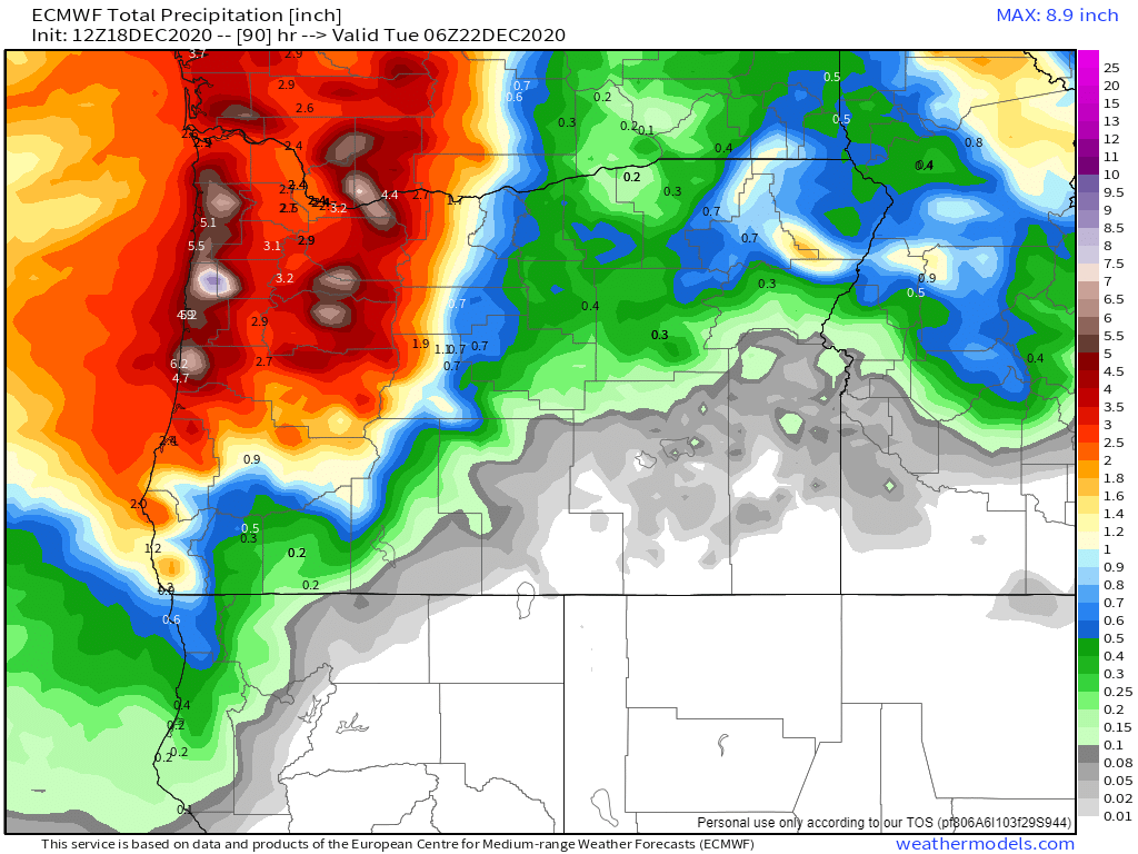
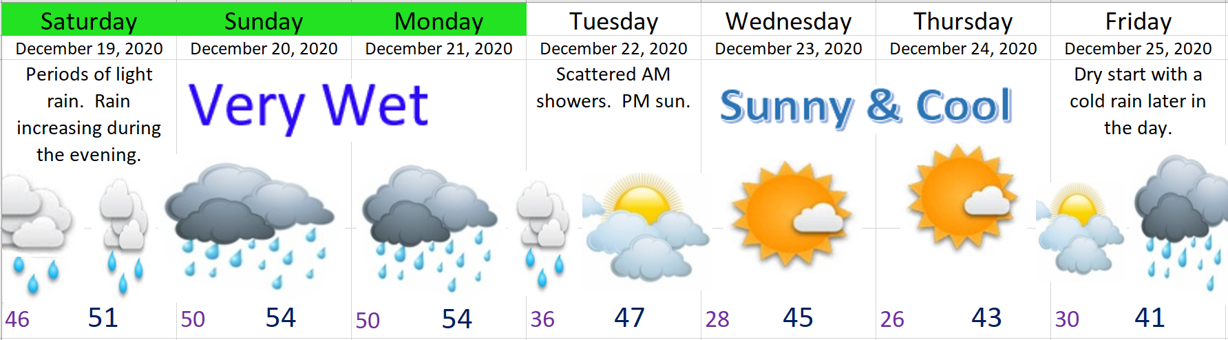
Saturday night and Sunday will be the wettest period with lots of steady, and at times heavy rain. This will also be the time to watch for some minor flooding. There’s currently a flood watch up for our region. I suspect the flooding will be contained to smaller creeks and streams and some of the more “typical” low laying areas, but keep an eye out just in case. Here’s what the next 7 days look like.
Highlights
1.) If you have to get things done outside then Saturday is your best bet with a few dry breaks during the day before the steady rain moves in Saturday night.
2.) Chilly air moving in will change our warm rain into a cold rain during the day on Monday. In fact, our high temp will likely be during the morning hours as we gradually cool through the day. By Monday night the snow levels will be down into the foothills and the Coast Range.
3.) Cold and dry leading up to Christmas.
4.) A chilly rain Christmas day. Yeah, that’s not real exciting, but unless it can somehow be colder than what is currently being predicted, I just don’t see anything other than a cold rain that day.
The Cascades
The Cascades will see rain for the majority of this incoming system; however, Christmas skiing will be saved thanks to the cold air arriving on the backside of this storm. 6 to 12 inches of new snow should fall Monday through Tuesday. More snow should fall late in the day on Christmas as well as the day after making for some excellent Christmas break skiing!!! Hoodoo currently has 41 inches at its base which is not too shabby for this time of year.
Take care and stay safe!!
