
We’ve kicked off December on a rather dry note. 10 days in the bag and we have only received 20% of our usual rainfall. A very dry start to the month!! Of course these things tend to balance out, and sure enough the next couple of weeks look wet with lots of Cascade snow and plenty of valley rain.
Highlights
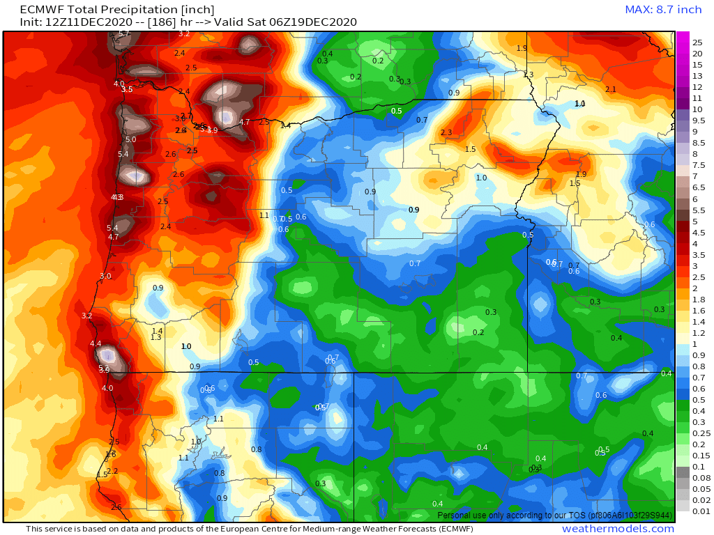
1.) This map shows about 2 to 3 inches of rain through Friday of next week with rain almost every single day.
2.) Both Saturday and Monday will be the only mostly dry times over the next 10 days. Keep this in mind if you’re wanting to do stuff outdoors.
3.) No big wind storms, flooding, snow or ice on our horizon; although there will be some snow and ice in the Gorge at times on Saturday night and Sunday morning should your travel plans take you out there – specifically east near Hood River and The Dalles.
4.) Large swells/waves are forecasted along the coast beginning on Sunday and lasting through at least the middle of next week. You can also expect gusty winds out at the coast with the storms coming in this week.
5.) Up in the Cascades 20 – 30″ of new snow now through next Friday! Best travel days will be Saturday and Monday as they will be drier. Thursday & Friday will be somewhat decent travel days in that there will be rain, not snow falling up in the passes. This also means Thursday & Friday may not be the best time to go skiing (unless you enjoy skiing in the rain lol). Nice to see that overall the snowpack will continue to grow this week.
There you have it. Fairly typical stormy December weather with rain down here and lots of mountain snow.
Take care and stay safe and healthy!!
