
Fox 12 Weather provided this nice graphic showing peak wind gusts from our storm Friday morning.

My forecast of 35 – 50mph turned fairly well and in the tricky world of forecasting I will jot this down as a win. 🙂
Storm number two is rolling in now. The rest of today is going to be very wet with steady rain increasing through the day and turning heavy tonight. Expect well over an inch of rain to fall by this time tomorrow. Southerly winds pick up tonight as well with gusts 30 – 40mph.
The Next 7 Days
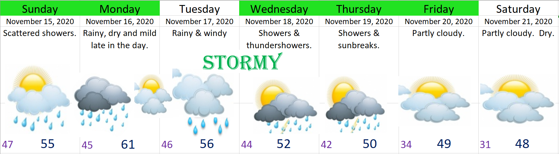
1.) Sunday still looks like the calmest day with scattered showers, sunbreaks, and fairly light winds.
2.) Monday: Rainy through the early afternoon. Mild and breezy. Temps will likely top out around 60°.
3.) Tuesday: Still watching the potential for another round of strong winds and heavy rain, but lots still up in the air with this system. Very stormy along the coast.
4.) Wed & Thu: Showers, breezy, and lots of mountain snow. Assuming businesses are allowed to operate, ski resorts should have one of the best starts to the ski season in years with close to 30 inches of snow currently being reported at Hoodoo and more on the way later this week. There will be some melting Sun – Tue with the milder weather, but overall it looks like we are off on the right track in the snowpack department!!
Have a fantastic weekend!
