
Up until these past two days this month has been warm. Currently we are running about 3.5° above normal for the entire month which is quite impressive and one of the warmer Octobers we have had in a long time, but things are starting to balance out a little. Yesterday cool air moved in, and this morning we had our coldest low temp of the season with a low of 33°. This weekend even chillier air moves in bringing low temps below freezing for the first time since last April.
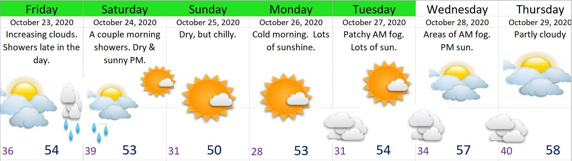
The storm coming in Friday evening will bring some much cooler weather, but not a whole lot of precipitation at all. I’m thinking nothing more than a few showers Friday afternoon/evening and maybe a leftover shower or two Saturday morning before drying out. Plan on Saturday afternoon being a dry, but cool.
Sun – Tue: Even colder with morning lows 28 – 32 degrees, and highs 50 – 54°.
Looking further out I see no sign of any significant rain. Warm or cold the one thing that’s been consistent this month has been dry weather. A moderate to strong La Nina is still being predicted for this winter (November – March) which means this unusually dry weather may not last much longer, so I suppose we should continue to enjoy it while it lasts. In case you missed my incredible write up on what I think might happen this winter you can follow the link below. 😉
https://bryanweatheralert.com/2020/09/28/winter-2020-2021-outlook/
Alright, enjoy the cool fall weather and stay safe & healthy out there!
