
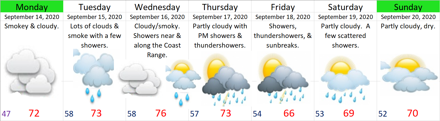
Well, we have another busy week in store as we slowly clear out of this smoky mess, plus we have a chance for thunderstorms this Thu & Fri. First things first, with no significant winds in the forecast in the near future it’s looking like the smoke will be with us to some extent now until Thursday. 😦 It should improve a little Mon night and Tue, especially in the locations that get some good rain showers, but a change in the winds aloft (up high) will likely bring more smoke back into our region on Wed…
My thinking hasn’t changed in terms of who gets rain Mon – Wed and who doesn’t. Showers will generally be confined to locations along & west of I-5. Many places in the Santiam Canyon and eastern Willamette Valley will not see much in the way of rain until Thu. Below is the latest total precip forecast map which goes through Wednesday.
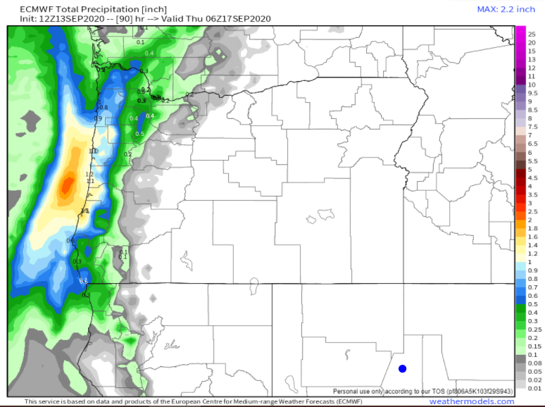
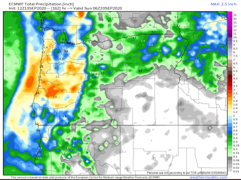
The coast & Coast Range get around an inch of rain and Salem receives nearly half an inch while locations like Detroit, Mill City, Lebanon, and Sweet Home see little more than a few sprinkles. This next map shows estimated precipitation totals through Saturday night. The second half of the week is definitely looking much wetter for those eastern locations.
Extended Forecast
The key thing to remember is that for Mon – Wed the potential for rain increases quite a bit as one heads further west, and it won’t be until Thursday when rain showers finally move through the entire region giving everyone a decent soaking.
The other highlight for this week is the chance for thunderstorms both Thu & Fri. Fortunately there should be plenty of rain (maybe some hail as well) with these storms limiting any new fire threats from lightning.
Hang in there and stay healthy…
