
We have some extremely wet weather coming up for the second half of the week. I have plenty of details for you all below.
Extended Forecast
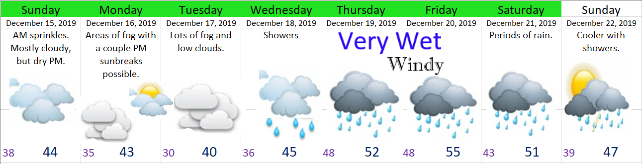
Details
Mon & Tue: Foggy, cool, and grey. The calm before the storm.
Wed: Increasing clouds with showers.
Thu – Sat: Extremely wet with extended periods of rain (fairly heavy at times) leading to totals of 2 – 4 inches for the mid Valley. Localized flooding seems like a real possibility with so much rain in such a short timeframe. Windy Thursday afternoon through Friday morning with gusts 25 to 35mph.
Sunday: Showers around and cooler.
The Cascades
This will be a warmer storm system which means only some of the precip will fall as snow. I’m currently forecasting 10 to 15 inches for the Oregon Cascades above 4500′ for the week. Much larger amounts of snow for the Washington Cascades where the airmass will stay a little bit cooler.
The Coast Range and Coast
Tons of rain with 5 – 10 inches (or more) Wed – Sat. Expect some landslides and mudslides along with some sharp rises in the rivers and streams in these regions.
