
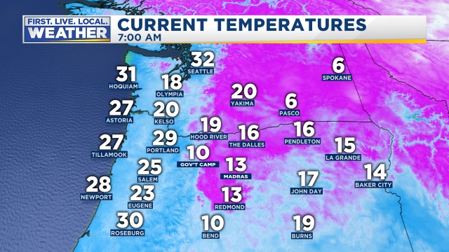
It’s March 4th, but it sure doesn’t feel like it. We are currently under the influence of a modified arctic air mass. At my place in the hills of south Salem I recorded a low temp of 18°!!! Check out the extremely cold temperatures across the region from this morning.
Doesn’t look like March… Here are a couple of pics from earlier this morning which convey pretty well just how chilly it was out there. The first pic is east of John Day, and the second pic is the top of Santiam Pass by Hoodoo.


Extended forecast

Highlights & Details
Rest of today & Tuesday: Very cold, especially at night and through the morning hours. Lots of sunshine.
Wednesday: Subject to change; however, confidence is growing that we will see some light snow, or a wintry mix of ice and snow before switching over to a rain/snow mix during the afternoon hours. This could be similar to the little snowstorm we had last Tuesday night/Wednesday morning.
Thursday: A few showers. Snow could mix in as we stay in a chilly pattern.
Friday: Heavy showers with wet snow, ice pellets, & hail all possible. Staying cool.
Saturday: Showers possible.
Sunday: Drying out and sunny.
