
A snowstorm for the mid and southern Willamette Valley looks to be right on track for tonight and tomorrow morning.
Timing & details: Sometime around 10 or 11pm a rain/snow mix will begin. It won’t take very long to switch over to all snow. Snow will continue through the early morning hours before changing to a few light snow showers for the rest of the day and possibly lasting into the evening. Corvallis down to Eugene should score some really big snow totals. Quite likely in the 7 to 12 inch range. The Salem area will likely be lower with 3 to 5 inches being a likely outcome for us. The Portland metro area will likely receive the lowest snowfall totals with only a dusting to 3” likely up there.
Keep in mind how small shifts in the track of the storm can make big differences regarding snow totals. One of the game changers I mentioned yesterday is that if the storm and main precip band moves a little bit further from where it’s forecast to go than we could easily see more (or less) snow. Right now I’m happy with the 3 to 5 inch forecast, but don’t be surprised to see more than that.
You can also keep tabs on the incoming storm with this link right here. You can see a nice stream of clouds and moisture headed right into Oregon, and with cold air coming in we have the right ingredients for a nice snowstorm!
Rest of the week
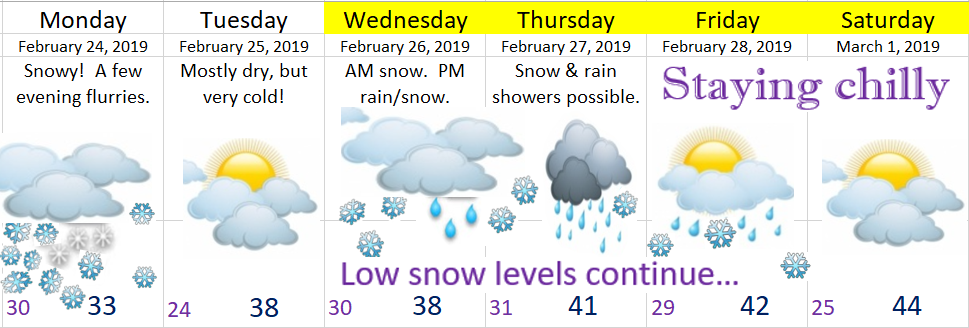
Tuesday: Very cold, but dry.
Wednesday – Friday: More snow opportunities as we stay in an unusually cold wintry pattern.
