
Highlights
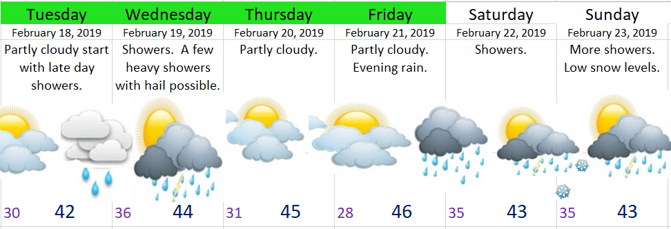
We have two main storms coming in over the next 6 days. The first will bring showers as early as Tuesday afternoon and will last through Wednesday night. We are dry Thursday and most of Friday before storm number two rolls in Friday evening. Cold showers will dominate both Saturday & Sunday.
Details
Wednesday: Cool and showery. Some showers will be heavy and could contain hail or ice pellets. Snow levels around 1500’ with 7 – 12 new inches of snow for the Cascades.
Thursday: Dry
Friday: Dry with evening rain.
Saturday & Sunday: Cold & showery. Basically a near repeat of Wednesday’s weather. Very low snow levels with another 10 to 16″ of snow above 2000′ and up to 5″ above 1000′.
Bottom line: Colder than normal temps continue with lots of mountain snow. Expect snow even in the Coast Range at times Wednesday, Saturday, and Sunday mornings.
