Forecast
Looking ahead I don’t see a good setup for snow still. I don’t see a big warmup either as we continue to stay in this cold and wet pattern for the foreseeable future. That part of the forecast has worked out very well as February is currently running far below average for temperature.
Storm recap
The past 36 hours have been wild and interesting to watch unfold at least from a weatherman’s perspective. We had gusty south winds all Monday night and through Tuesday morning. I’m sure you noticed them. Gusts to 40mph were reported four separate times at the Salem airport. Meanwhile areas to our northwest have been pounded by heavy rain causing flooding on many creeks and streams specifically up in Washington, Clatsop, and Tillamook counties. Here’s what the radar looked like Tuesday morning. Two things stand out. First is the heavy rain just to our north, and the second is the heavy snow (in blue) just west of the Portland Metro area.
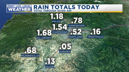
I work very hard writing my own forecasts and making my own graphics, but I just don’t have a fancy studio or programs to create nice graphics which means today I’m borrowing from a local professional. This image is brought to by Mark Nelson over on Fox 12 Oregon. These precip totals were only through 10am, so I imagine much more fell as the day went on!! You can clearly see locations to our north and west received far more rain this morning which led to the flooding issues up there. I’ll try to have some official rain totals later.
Then there was the gorge where cold air kept snow falling along I-84 all day long. Here’s I-84 at Cascade Locks from Tuesday morning.
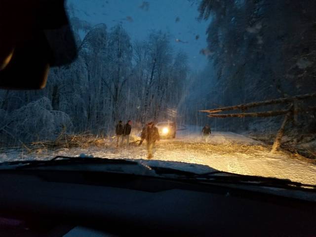
No snow today as you might have noticed here in the Salem area, and that’s primarily a result of just not enough cold air and the rain band stalling a little too far north of us as the previous images revealed. If the precip band had been directly over us it could have been a different story. The locations where it did stall saw heavy wet snow fell below 1000′ causing trees to fall and messes like this scene from highway 6 early Tuesday morning in the northern Coast Range.
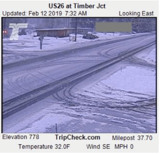
Some additional proof that snow fell to low elevations Tuesday morning. Here’s US 26 west of the Portland metro a little ways. You can see snow had no trouble here sticking down to 778′ and even a bit lower in surrounding areas. All in all a crazy day!
I am sorry about the lack of a good snowfall here, but I’m thinking there’s nothing I can do about it. Trust me I’m just as sad, and I keep telling myself this must be setting us up for an incredibly huge amount of snow sooner than later. I mean that’s got to be how it works, right??? After all, Portland has received several inches so far this winter, Seattle is looking at historic snowfall for February, and even as I write this, it’s snowing and 32° in Redding California right now!!! Sooner or later Salem has got to receive its “fair share” of snow.


