
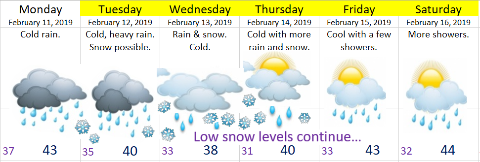
Quick highlights
Monday: Cold rain. No issues.
Monday night – Thursday morning: During this period of time we will be having near constant precipitation as a couple of storms essentially stall directly over the region. Total precip between now and Thursday will be in the 3 to 4 inch range!!! That will cause some localized on our smaller creeks and streams and some low laying areas. No concern regarding the bigger rivers. Notice I still have lots of snowflakes on the extended forecast below indicating that we will be “flirting” with snow much of the week, but for now I’m still leaning towards us just getting plain rain this week.
Beyond Thursday we stay colder than normal and wet.
Extra Details
Predicting snow around here truly is a pain in the, well you know… Anyway, there are so many factors that have to be considered, and tonight I have some more “game changers” for the Tuesday – Thursday timeframe which could give us some heavy wet snow.
Some of the forecasting models indicate steady and heavy precip could drag the snow level down to the valley floor. This has happened before. It’s how we got that snowstorm in March several years ago. The problem with this setup is everything has to come together just right or else we end up with only cold rain. Check out this simulated radar image for early Tuesday morning. It shows in the blue some very heavy snow falling in parts of the valley while the rest of us sit under a cold heavy rain. Hard to say what will happen….
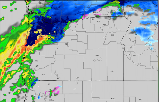
Of course there are countless other maps and charts I look at, but this one I felt did the best job of showing how borderline we are going to be this week with seeing or not seeing snow. Something to keep in mind. Look for another update by Monday night as I should have a better idea by then.
Enjoy your Monday 🙂
