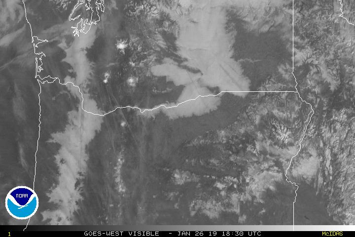
All week long I’ve mentioned my concerns about fog developing this weekend keeping our temps cooler than they would otherwise be. Turns out the fog won. You can see the entire valley cloaked under the blanket of fog on this visible satellite image from this morning.
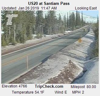
If we had stayed free of the fog (say that 3 times fast) we could easily be in the 50s right now. Just look at the temp at the top of Santiam Pass right now. It’s a balmy 54° with more daytime to come. It will get up to almost 60 up there today!! Back here in Salem it’s a nice cool 39° thanks to our fog 😉
I see no reason why Sunday and possibly Monday won’t also end up foggy. In fact there’s a chance for fog almost every single day this next week. The only exceptions are the days it’s supposed to rain lol… Here’s a look at the next 7 days. Notice the lack of green highlighting indicating the variability in our temps which all depend on how much or how little fog we end up with.
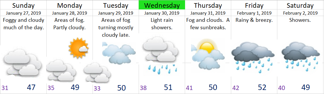
- Dry through Tuesday
- Showers on Wednesday
- Dry Thursday
- Wet for next weekend
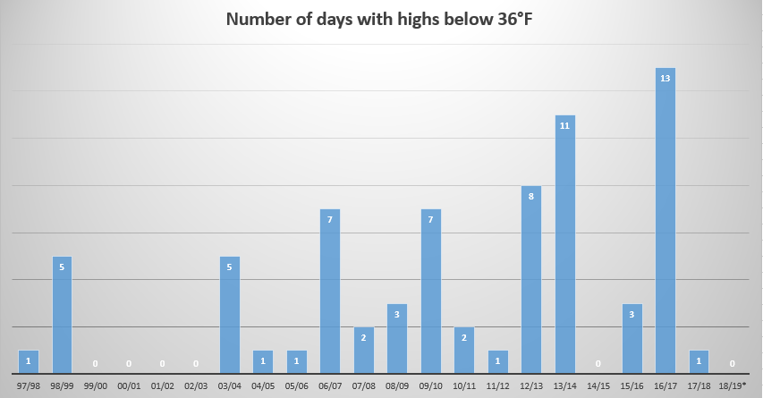
Last, but not least I have some food for thought. This graph shows the number of days with highs below 36°F per winter for Salem, OR. It goes back to the winter of 1997/1998. In the scheme of things this is a very short time frame, so don’t draw too many conclusions from it. I just thought it was a fun bit of info to share.