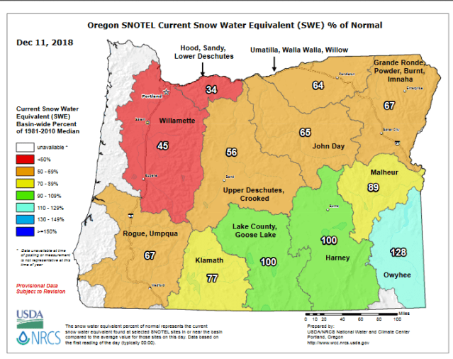
This map depicts the percentage of water stored within the snowpack relative to normal. You can see most of the state is well below normal. A combination of mediocre storms and lots of dry days (think back to just last week) and we end up with this low, below average snowpack.
Notice how the southern regions are reporting close to and even above normal conditions. Above average precip in southern Oregon is common during El Nino winters (like the winter we are in now), and I expect that trend to continue.
To give you an idea of how low the snowpack is, the current base at Hoodoo ski area is 18.5″ of snow. Not very good.
Forecast
In the meantime I see 5 to 12 inches of snow coming for the mountains tonight and tomorrow. More the higher up you go in elevation, but even a few inches as low as 2500′ are possible.
Beyond tomorrow I don’t see very much snowfall in the forecast unfortunately. Hopefully later in the month we can get a series of colder and wetter storms to really build the snow up a bit more.

