
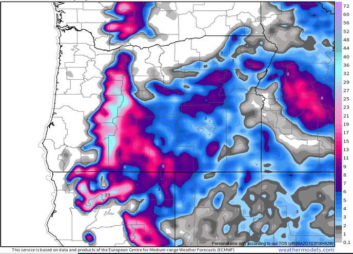
Mountain snow will be returning in full force Thanksgiving weekend. This image shows the estimated total snowfall measured in inches by Saturday afternoon. Looking at this we can see widespread 15 – 20 inches of snow for the Cascades. It also shows a bit of snow for the Siskiyous down to our south. This is great news for ski resorts, for our snowpack, and watershed.
To break it down in more practical terms: the best travel times will be any time before Thursday afternoon and then again any time after Saturday morning. The time frame in between will be a snowy period with the snow levels generally 3000’ – 4000’.
In the gorge
Windy conditions will persist now through Wednesday. The west end of the gorge will be the focus of these winds with gusts up to 60+mph near Troutdale and out towards Multnomah Falls.
Along the coast
Our storm Thursday evening and Friday will bring wind guests into the 50 – 65mph range, so very windy weather over there.
